Cover of Colorado Fruita - Colorado Fruita - Grand Junction - Trails and Recreation Topo Map | Latitude 40° | Blue Ridge Overland Gear
Colorado Map locator for Colorado Fruita - Grand Junction - Trails and Recreation Topo Map | Latitude 40° | Blue Ridge Overland Gear
Fruita  Grand Junction Topographic Map Index for Colorado Fruita - Grand Junction - Trails and Recreation Topo Map | Latitude 40° | Blue Ridge Overland Gear
Mack Ridge Inset section of Colorado Fruita - Grand Junction - Trails and Recreation Topo Map | Latitude 40° | Blue Ridge Overland Gear
North Fuita Desert section of Colorado Fruita - Grand Junction - Trails and Recreation Topo Map | Latitude 40° | Blue Ridge Overland Gear
Palisade Rim Trail section of Colorado Fruita - Grand Junction - Trails and Recreation Topo Map | Latitude 40° | Blue Ridge Overland Gear
Rabbit Valley section of Colorado Fruita - Grand Junction - Trails and Recreation Topo Map | Latitude 40° | Blue Ridge Overland Gear
18 Road Inset section of Colorado Fruita - Grand Junction - Trails and Recreation Topo Map | Latitude 40° | Blue Ridge Overland Gear
Colorado Fruita - Grand Junction - Trails and Recreation Topo Map | Latitude 40°

Colorado Fruita - Grand Junction - Trails and Recreation Topo Map | Latitude 40°

Latitude 40 SKU: LAT1-879866-35-8

Colorado Fruita - Grand Junction - Trails and Recreation Topo Map | Latitude 40°

Latitude 40 SKU: LAT1-879866-35-8
Regular price $14.95
/
Shipping calculated at checkout.
  • Kokopelli’s Trail
  • Colorado National Monument
  • Black Ridge Canyons Wilderness

Five inset maps (at 1:37,500 covering the most popular riding areas)

  • 18 Road
  • Book Cliffs Recreation Area
  • Kokopelli loop trails area
  • Lunch Loop area trails
  • Bangs Canyon Special Recreation Management Area
  •  and (at 1:75,000) Kokopelli’s Trail from Westwater Road to Dewey Bridge

Size

  • 39.3″x  25.2″ flat
  • 8″x 4″ folded

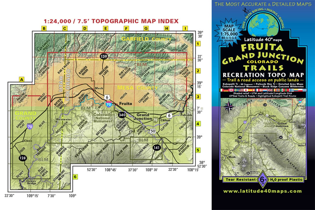
Scale   1:75,000; 1 inch = 1.2 miles or 1.9 km

Contour Interval   80 feet with shaded relief base

Latest Edition 6th – 2019

Map Coverage   covers all or part of all or part of 40 USGS 1:24,000 7.5-minute topographic maps

  • North – 18-Road Book Cliffs Recreation Area
  • South  Westwater-Glade Park-Bangs Canyon-Whitewater
  • East – Westwater-Glade Park-Bangs Canyon-Whitewater
  • West – Dewey Bridge

We love these maps. They are extremely durable, waterproof, and tear resistant. We recommend that you protect your maps for years of good use but they are made for adventure and are near to indesctructable!

Use collapsible tabs for more detailed information that will help customers make a purchasing decision.

Ex: Shipping and return policies, size guides, and other common questions.

Recently viewed